Photos that will make you visit Blyde River Canyon
Up until a few weeks ago, I had never personally been to Blyde River Canyon before and now I’m convinced it’s one of the most beautiful places on earth. I didn’t think many places could rival the Western Cape’s scenery but I was wrong.
This trip to Mpumalanga was spontaneous to begin with and I definitely didn’t have enough time to explore every part of his beautiful region but the bits I did see were mind blowing, so I had to write this short article with the hope of enticing you to visit for yourself.
But instead of me telling you how amazing it is, I’d like share some photographic evidence of the beauty!
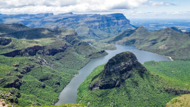
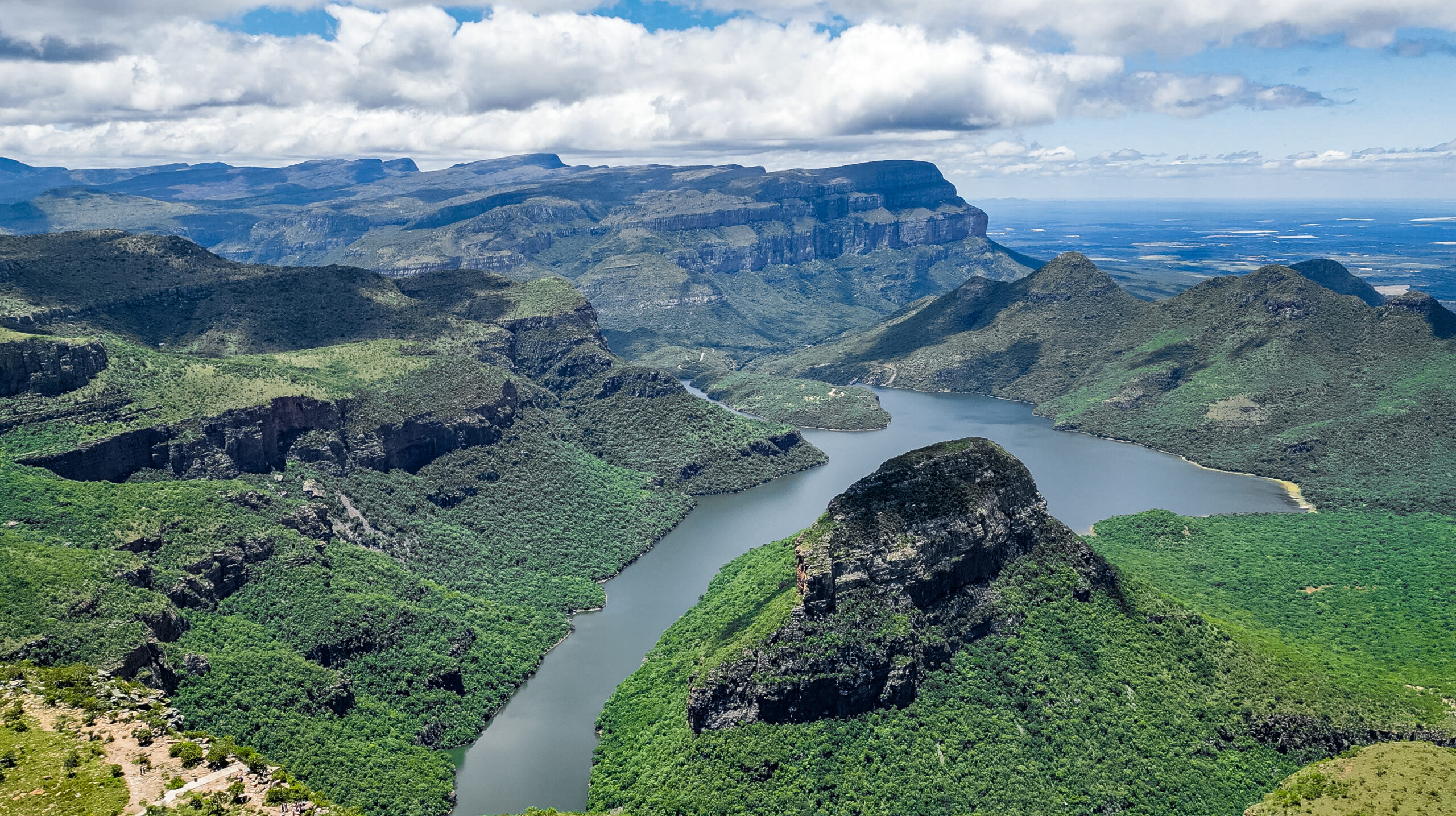
The Blyde River Canyon is the third largest canyon in the world after the Grand Canyon in the United States and the Fish River Canyon in Namibia. It’s also the largest ‘green canyon’ due to its lush subtropical foliage, with the deepest precipitous cliffs of any canyon on the planet.
The Blyde River Canyon is 26 kilometres in length and is, on average, around 800m deep. The dam itself, when full, is at an altitude of 665m (2182 feet).
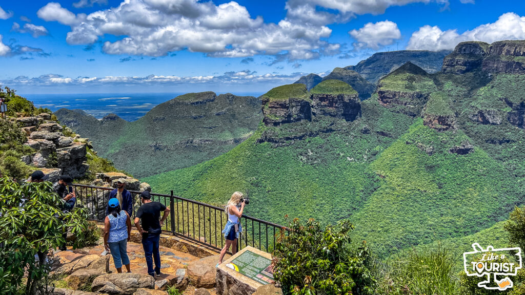
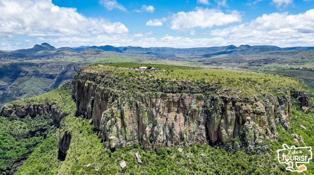
As part of the Panorama Route, the Blyde River Canyon has beautiful rock formations known as the “Three Rondavels” which are round mountain tops with slightly pointed tops, very similar to the traditional round or oval African homesteads made with local materials called rondavels.
The Three Rondavels are sometimes referred to as the ‘Chiefs Troublesome Wives’, with the flat-top peak representing the chief, Mapjaneng, and the Rondavels representing his three wives. The view from the Three Rondavels lookout point is widely considered the finest in South Africa.
They are also sometimes also called the Three Sisters (although this confuses them with a similar threesome visible from the N1 in the Free State lower down in the country).
How were these magnificent mountains formed? Apparently erosion wore away the soft underlying stone, leaving exposed slate and quartzite that shape these dramatic rock formations.
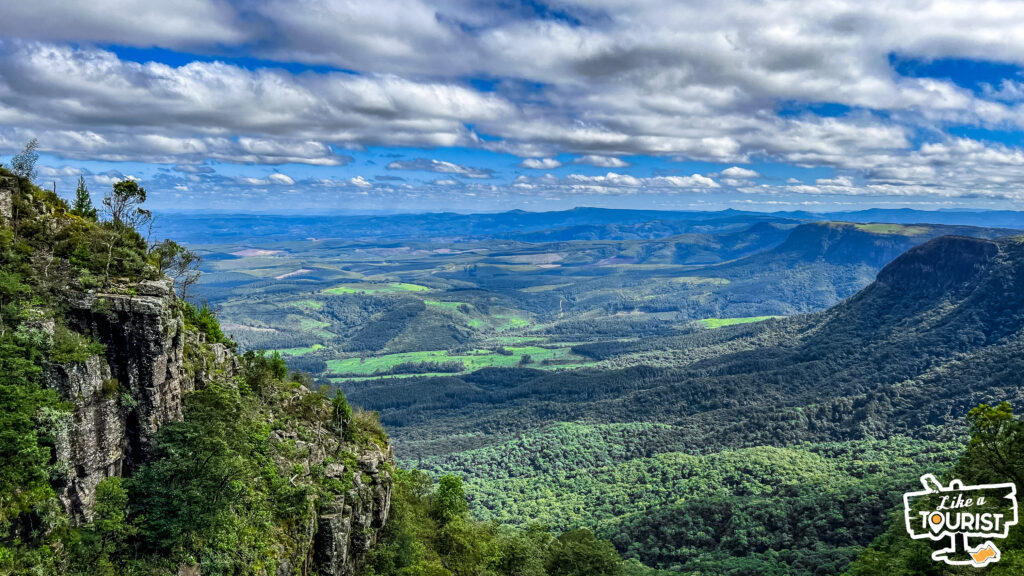
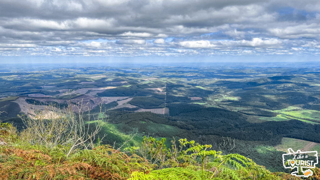
Situated on the Drakensberg escarpment in Mpumalanga is God’s Window. Just one look down and you will begin to understand how it got it’s name.
Gods Window is so called for the panoramic view of the Lowveld more than 900 meters down into lush indigenous forest clad ravine.
The majestic cliffs plunge over 700 meters to the Lowveld and the private game reserves which have made the area one of South Africa’s main wildlife destinations.
God’s Window is a small part of a 250km long earthwork of sheer cliffs and extravagant beauty. One can observe the hills and forests as far as the eye can see. In fact, it seems as if one can see forever!
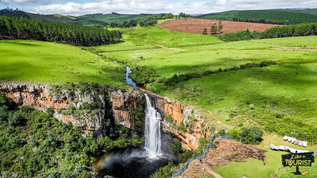
Shaped like a huge white candle, the Berlin Falls flow through a natural sluice before cascading down into a deep pool. It’s a great place for a swim followed by a picnic.
The Berlin Falls are among a cluster of Sabie waterfalls comprising the Horseshoe, Lone Creek and Bridal Veil Falls, the Mac Mac Falls and Mpumalanga’s highest waterfall: the 90m Lisbon Falls.
Why is it called Berlin Falls? Berlin Falls got its name from miners who ventured to South Africa from Europe during the gold rush, and named each waterfall in the region after their home towns, or places from their home countries.
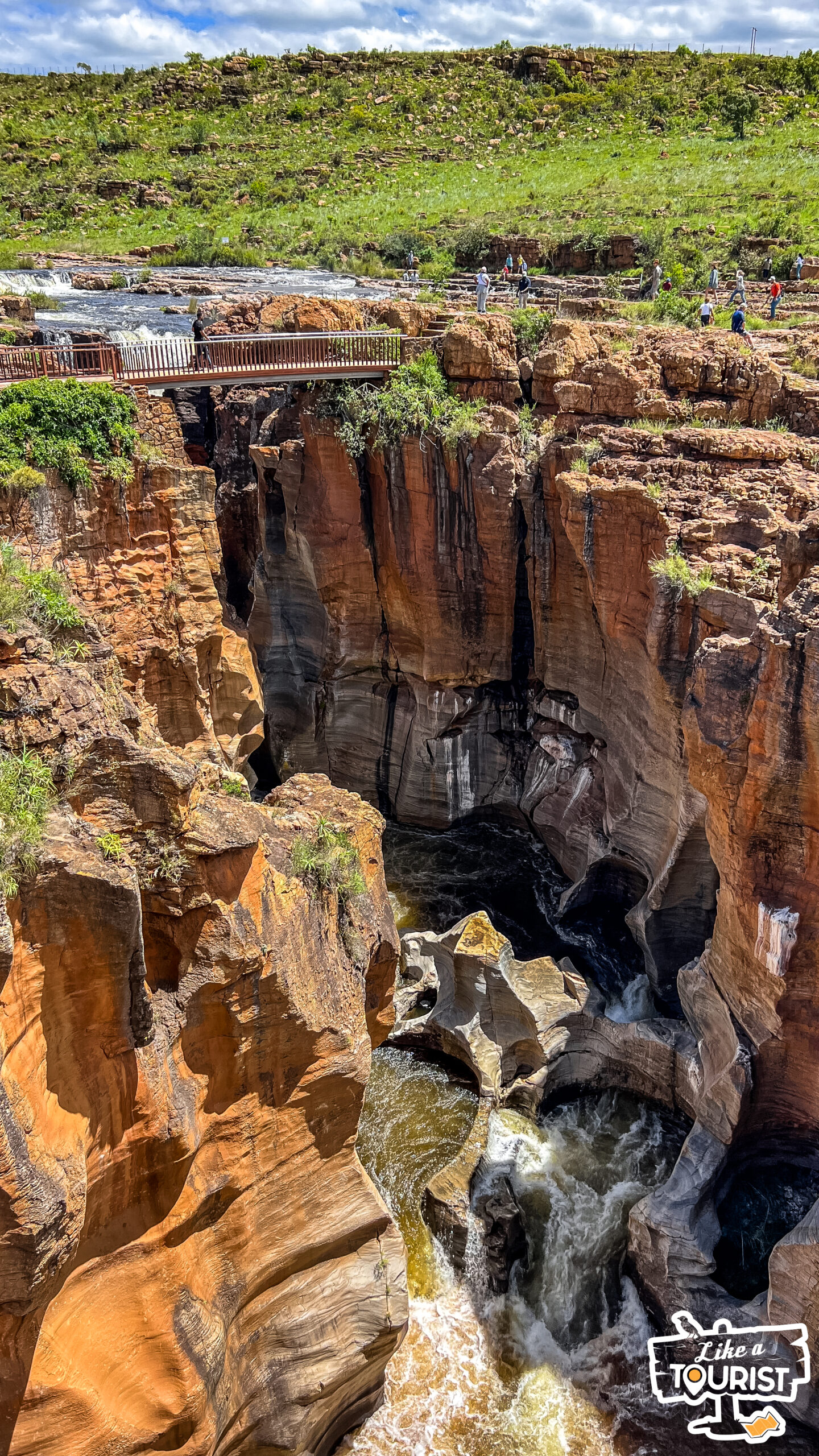
At the merging of the Blyde River and the Treur River, thousands of years of water erosion have created a unique and otherworldly geological feature known as Bourke’s Luck Potholes.
At the mouth of the Blyde River Canyon, the two rivers formed swirling whirlpools of water. Over time, this formed huge cylindrical potholes in the sandstone bedrock. The effect, seen from the crags above, is now a fascinating network of tunnels and tubes and interconnected whirling pools. The different soil levels in each hole give them each a unique color and makes for a striking and colorful landscape.
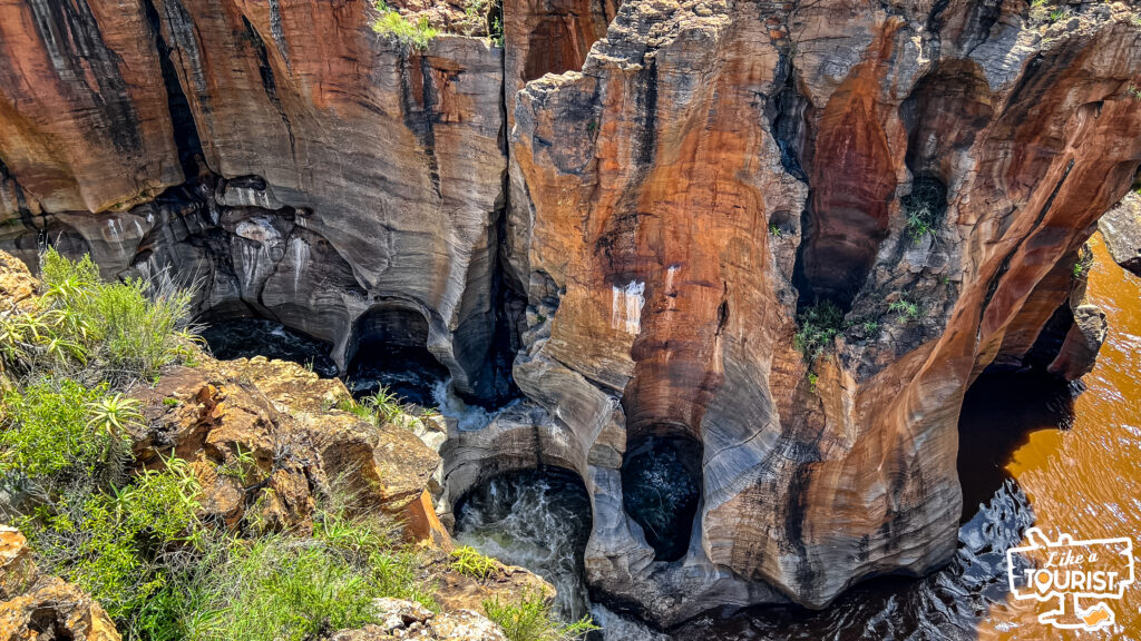
The formations got their name from a prospector, John Bourke, who was one of the first to proclaim that the region had gold deposits and who staked a claim nearby. Despite the name of the potholes, he never found a single ounce of gold there — though luckier prospectors would later find rich amounts of gold in the area. Even if he walked away empty-handed, his name lives on in the stunning scenery.
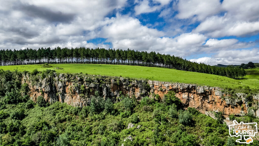
The Blyde River Canyon Nature Reserve in which the potholes are located, has bridges and viewing platforms that allow visitors to see the interesting rock features from a variety of angles. There is also a small but interesting geological museum and short walking trails.
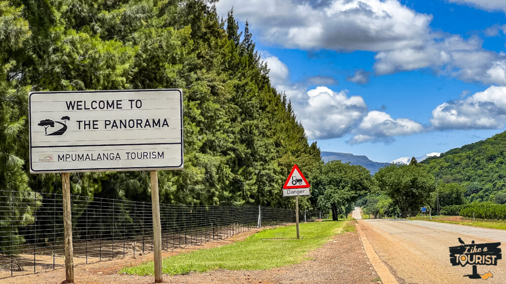
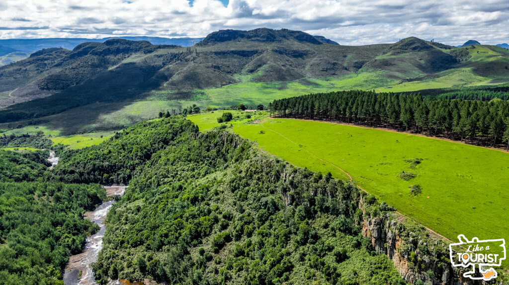
One of the country’s most scenic self-drives, the Panorama Route, explores the Mpumalanga highlands, or the north-eastern section of the Great Escarpment of the Drakensberg.
The magnificent Panorama Route in South Africa’s Mpumalanga province is one of the continents great natural wonders and one of the world’s most beautiful driving routes.
In these rugged mountains, the plateau comes to an abrupt and dramatic halt, falling steeply away into the Lowveld accompanied by incredible views out over the grasslands of Africa.
When I got back from from this short trip, I was incredibly proud of these pictures and I had to share them with all of you. That said, I swear to God that they don’t do any justice to the beauty and magnificence of the Blyde River Canyon.
My team and I will be making our way back in a few weeks to shoot a YouTube video about the area. Our goal is to create travel content that will inspire people to visit the area for themselves. It would mean the world to us if you took a moment to watch our video about the magical town of Dullstrrom below so that you can get an idea of the production quality.
If you like what you see, please consider subscribing to our YouTube channel, as well as liking the video and leaving a comment. This helps the YouTube algorithm direct more people to our channel.
I can’t wait to go back to the Blyde River Canyon region and I hope this article inspires you to experience the magic for yourself. I’d like to leave you with one last picture that hits me in the heart every time I look at it. It’s one of the many reasons why I think South Africa is the most beautiful country on earth!